Wetland Resources
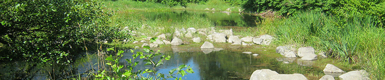
Columbia River North Jetty Wetland Mitigation Bank Use Plan
US Army Corps of Engineers, with Harbor
Consulting Engineers 
The Corps conducted a major rehabilitation
project to repair portions of the North Jetty
that maintains the federal navigation channel
at the mouth of the Columbia River. A
mitigation plan was needed to compensate for
fill in a 5.5-acre saltwater lagoon that had
developed behind the jetty and several
intertidal and non-tidal wetlands located
along the access road. On-site mitigation
options were limited due to construction
sequencing and the location of the jetty
within a state park, so Meridian worked with
the Corps to develop a Wetland Mitigation Bank
Use Plan. The plan combines credits from two
different banks in order to provide equivalent
or higher-level wetland functions and values.
Sunset Wetland and Riparian Habitat Study
Snohomish County PUD 
The PUD is proposing to construct a 30-MW
run-of-river hydropower project on the South
Fork of the Skykomish River. Meridian
conducted wetland delineations, stream typing,
and mapping of the ordinary high water mark;
classified wetlands and streams to determine
buffer requirements; and then developed a plan
to avoid, minimize, and mitigate project
impacts on these resources. This plan will be
included with the federal licensing documents.
John Street Substation Expansion Wetland Delineation and Mitigation Plan
Cowlitz PUD
Meridian delineated wetlands within the area
of a proposed expansion of the John Street
Substation in the City of Longview. We
determined the ordinary high water mark of an
adjacent stream, then evaluated the wetland
and stream buffer condition and prepared a
mitigation plan to compensate for the proposed
buffer reduction. Mitigation involved
long-term buffer protection, as well as
vegetation enhancement with native trees and
shrubs.
North Arm Campground Wetland Evaluation
Portland General Electric 
Meridian evaluated wetlands in the vicinity of
proposed improvements to the North Arm
Campground, located on National Forest System
lands adjacent to Timothy Lake, Oregon. The
results of the evaluation were used to refine
the design of the campground, access road, and
boat launch to avoid or minimize impacts on
wetlands. Meridian followed up with a formal
wetland delineation to quantify project
effects that could not be avoided and
identified measures to minimize and mitigate
for impacts that were included in PGE's
permitting package.
Wetland Evaluation of Proposed Lower Elwha Valley Road
Lower Elwha Klallam Tribe 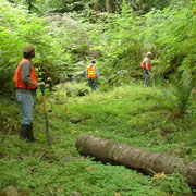
Meridian delineated all wetlands and streams
along a road proposed to provide access to the
Elwha Reservation, drafted a wetland
delineation report, and developed strategies
to mitigate unavoidable wetland impacts.
Mitigation primarily involved removing a berm
to reconnect about 80 acres to the Elwha River
floodplain. The mitigation strategy were
favorably received by the Department of
Ecology, Corps of Engineers, WDFW, and the
Tribe. Meridian prepared all applications for
environmental permitting and the road was
developed.