
Terrestrial and Wetland Resources
Terrestrial Resources
Wildlife Habitat Management Plan
Cowlitz PUD
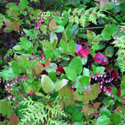
Meridian developed a Wildlife Habitat Management Plan for the Swift No. 2 Wildlife Management Area, to be operated and maintained as a condition of a new FERC license. The plan specifies measures to accelerate the development of old-growth characteristics in young, dense forest stands, improve elk forage, control noxious weeds, minimize disturbance to wildlife, and protect wetlands and riparian habitat. These measures benefit species such as pileated woodpeckers, northern spotted owl, black-capped chickadee, yellow warbler, Roosevelt elk, dabbling ducks, and pond-breeding amphibians. Meridian continues to assist the PUD with implementation of the plan, including annual invasive plant and public access surveys, wetland and meadow assessments, and design of silvicultural treatments.
Regional Rare Plant Survey
US Forest Service
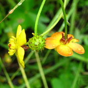
Meridian conducted surveys of plant community types to identify the presence and abundance of rare plants across four project areas on the Thorne Bay, Ketchikan, and Wrangell Ranger Districts of the Tongass National Forest. Projects included all or portions of the following survey areas: North Prince of Wales Island, Kosciusko Island, Heceta Island, Tuxekan Island, Zarembo Island, and Neets Bay-Shrimp Bay Peninsula on Revillagigedo Island. The surveys were completed to provide land managers with an understanding of the potential to find undocumented rare species in similar habitats across the Forest. Our surveys included searches for 101 vascular species on unique geological features in remote sites during 2010, 2012, and 2013. Meridian staff managed all project logistics, coordination with Forest Service staff, electronic data management and mapping, and technical reporting.
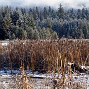
Sunset Vegetation Cover Type Mapping and Habitat Assessment
Snohomish County PUD
Meridian conducted a wildlife habitat study for the Sunset Fish Passage and Energy Project to evaluate the potential effects of a proposed 30-MW hydropower project on sensitive habitats and wildlife species with legal protection or special conservation or management designations. The study involved classifying and mapping existing vegetation, calculating changes in cover type acreages that would occur as a result of construction, and comparing habitat requirements of special status species with attributes of habitat in the project area. Results of the study will be included in Exhibit E of the license application and used to design a terrestrial resource management plan to offset project impacts.
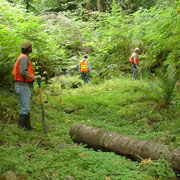
Tyee Transmission Line Invasive Plant Study
Southeast Alaska Power Agency
![]()
Meridian conducted several field studies as part of an environmental assessment to evaluate the effects of SEAPA's proposal to use an off-road vehicle to access approximately 27 miles of the Tyee Transmission Line. Meridian prepared an invasive species survey report and risk assessment, developed a list of priority species, and identified a set of cost-efficient best management practices and mitigation measures to minimize the introduction and spread of invasive plants without increasing the risk of additional ground disturbance.
Terrestrial Resource Protection Plan
Tacoma Power

As part of license implementation for the Cushman Hydroelectric Project, Meridian developed a Terrestrial Resource Protection Plan for Tacoma Power that includes two components. The first identifies measures to minimize short-term wildlife disturbance during construction and habitat enhancement activities, while the second presents guidelines for long-term land management. The plan evaluates all the license conditions that could cause adverse effects on wildlife, provides a list of best management practices, and defines specific measures to protect key species and habitats.
Wetland Resources
Columbia River North Jetty Wetland Mitigation Bank Use Plan
US Army Corps of Engineers
The Corps is currently conducting a major rehabilitation project to repair portions of the North Jetty that maintains the federal navigation channel at the mouth of the Columbia River. A mitigation plan was needed to compensate for fill in a 5.5-acre saltwater lagoon that had developed behind the jetty and several intertidal and non-tidal wetlands located along the access road. On-site mitigation options were limited due to construction sequencing and the location of the jetty within a state park, so Meridian worked with the Corps to develop a Wetland Mitigation Bank Use Plan. The plan combines credits from two different banks in order to provide equivalent or higher-level wetland functions and values.
Sunset Wetland and Riparian Habitat Study
Snohomish County PUD
The PUD is proposing to construct a 30-MW run-of-river hydropower project on the South Fork of the Skykomish River. Meridian designed and conducted wetland delineations, stream typing, and mapping of the ordinary high water mark; classified wetlands and streams to determine buffer requirements; and is currently in the process of developing a plan for avoiding, minimizing, and mitigating project impacts on these resources. Results of the study will be included in Exhibit E of the license application.
John Street Substation Expansion Wetland Delineation and Mitigation Plan
Cowlitz PUD
Meridian delineated wetlands within the area of a proposed expansion of the John Street Substation in Longview. Meridian determined the ordinary high water mark of an adjacent stream, then evaluated the wetland and stream buffer condition and prepared a mitigation plan to compensate for the proposed buffer reduction. Mitigation involved long-term buffer protection, as well as vegetation enhancement with native trees and shrubs.
North Arm Campground Wetland Evaluation
Portland General Electric
Meridian evaluated wetlands in the vicinity of proposed improvements to the North Arm Campground, located on National Forest System lands adjacent to Timothy Lake, Oregon. The results of the evaluation were used to refine the design of the campground, access road, and boat launch to avoid or minimize impacts on wetlands. Meridian followed up with a formal wetland delineation to quantify project effects that could not be avoided and identified measures to minimize and mitigate for impacts that were included in PGE's permitting package.
Watershed Management Plan
Unified Sewerage Agency
Developing the Beaverton Creek Watershed Management Plan involved addressing wetlands, riparian and wildlife habitat, and integrating findings with an evaluation of channel condition, fish habitat quality, soils mapping, water quality and the results of hydrology/hydraulics and pollutant loading models along 45 miles of urban stream. Meridian compiled a menu of treatments to minimize erosion, stabilize streambanks, address overbank flood storage and enhance off-channel wetlands which involved re-contouring and re-planting wetlands to improve their benefits for fish, waterfowl and wading birds, and native plant communities. Throughout the process, we participated in workshops, public meetings and site visits, and prepared technical materials for presentation and publication.
Wetland Evaluation of Proposed Lower Elwha Valley Road
Lower Elwha Klallam Tribe
Meridian delineated all wetlands and streams along a road proposed by the Elwha Tribe, drafted a wetland delineation report, and developed strategies to mitigate unavoidable wetland impacts. These were favorably received by the Department of Ecology, Corps of Engineers, WDFW, and the Tribe. Meridian prepared all applications for environmental permitting.